Our Cycling Route Through Albania

The green line on the map above shows the exact GPS route we have cycled. The pins on the map show our final destination for each cycling day. You can click on a pin to see the date we cycled.
Our cycling route through Albania
The map above shows the route we cycled through Albania. We entered Albania from it's western boarder with Montenegro and exited in the east into Kosovo.
Albania was our first real culture shock of the trip, the world took a very sudden change from the developed european world to a much poor and culturally different one.
The first and most noticable difference was the road quality and the change in vehicles. One unique thing about Albania is that 99% of people drive a Mercedes. It doesn't matter how old or new the vehicle is, so long as it's a Mercedes they want it! It's no exaggeration to that even the commercial vehicle (vans and trucks) are also Mercedes! It's quite a sight to behold.
The road quality and safety are significantly worse than the previously countries we visited, it's not that all of the roads surfaces are bad but there is a decent percentage (25%+) that were in poor condition. That being said the traffic was very light on our chosen route so dodging pot holes and the like wasn't a major problem.
Albania seems to take a bit of a "we dont care" approach to road safety, we had to to ride a short strech of dual carriage way when exting into Kosovo, about half way down this road our side was closed for road works and diverted us onto the opposite side of the carriage way, this was done via one single sign and there were no traffic cones or signs to way drivers on that side to expect oncoming traffic. It was quite a scary experience to be cycling into high speed oncoming traffic but thankfully all ended well.
I don't want to leave you thinking that Albania is a death trap to cycle through, it's not. You just need to be as safe as you can at all times.
On day 2 in Albania we took a "ferry" through the mountains. It's quite a unique way to travel through Albania and very popular with tourists, you can read more about this here.
If you'd like to take a closer look at our route or use it for your plans you can download the .kml file using the button below. For PC users you can view this file type in "Google Earth Pro", available here: google.com/earth/versions/, for Android users we recommend maps.me and for iPhone users we also recommend maps.me.
Download our Route through AlbaniaOur cycling stats for Albania
13.93 kmph
261.35 km
52.27 km
85.69 km
4,146 meters
832 meters
World Tour Stats
If you enjoyed these stats you can use the button below to see our complete statistics for the entire journey so far, along with our planned route and route taken.
View all World Tour Stats
Read more about our time in Albania
If you'd like to know more about our cycling adventure in Albania, including our ferry journey, first big crash and more click the button below.
Read More about our time in Albania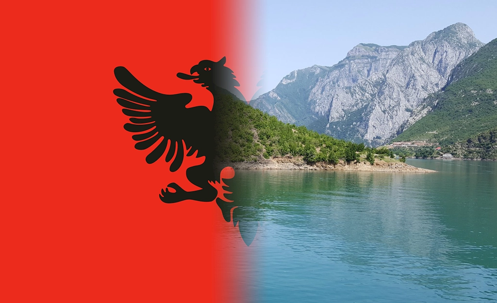
Daily Cycling Activity
Below is a breakdown of our daily cycling activity, you can see our exact route and final destination each day using the map at the top of the page.
| Day | Start/Finish | Distance | Duration | Avg. Speed | Elevation Gained | Elevation Min/Max |
|---|---|---|---|---|---|---|
| 5 |
Kukes to Prizren 15th June 2019 |
24.46 miles 39.14 km |
2:34 |
9.49 mph 15.18 kmph |
2,022 ft 616 m |
970 ft / 1,499 ft 296 m / 457 m |
| 4 |
Has to Kukes 14th June 2019 |
18.15 miles 29.05 km |
2:08 |
8.48 mph 13.56 kmph |
1,624 ft 495 m |
937 ft / 2,298 ft 286 m / 701 m |
| 3 |
Barjam Curri to Has 10th June 2019 |
42.09 miles 67.35 km |
5:15 |
8.00 mph 12.80 kmph |
4,481 ft 1,366 m |
777 ft / 2,728 ft 237 m / 832 m |
| 2 |
Shkoder to Barjam Curri 8th June 2019 |
25.08 miles 40.13 km |
3:25 |
7.33 mph 11.73 kmph |
3,052 ft 930 m |
244 ft / 1,251 ft 74 m / 381 m |
| 1 |
Bar to Shkodër (wildcamp) 7th June 2019 |
53.55 miles 85.69 km |
5:14 |
10.23 mph 16.37 kmph |
2,422 ft 738 m |
-7 ft / 756 ft -2 m / 230 m |
Post written by: Stewart
Comments
Ask a question or join the discussion below.
Go back to World Tour to see more content like this or checkout similar content below.
Back to World Tour
No comments have been made yet, be the first!